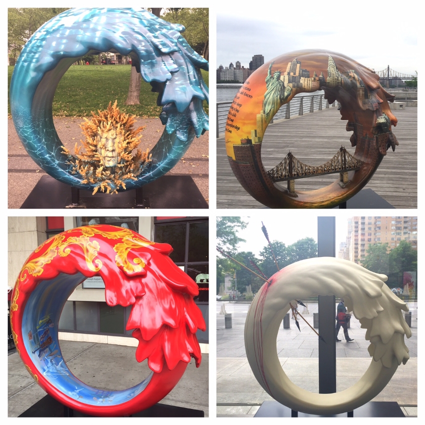
Kobra: Colors of Liberty
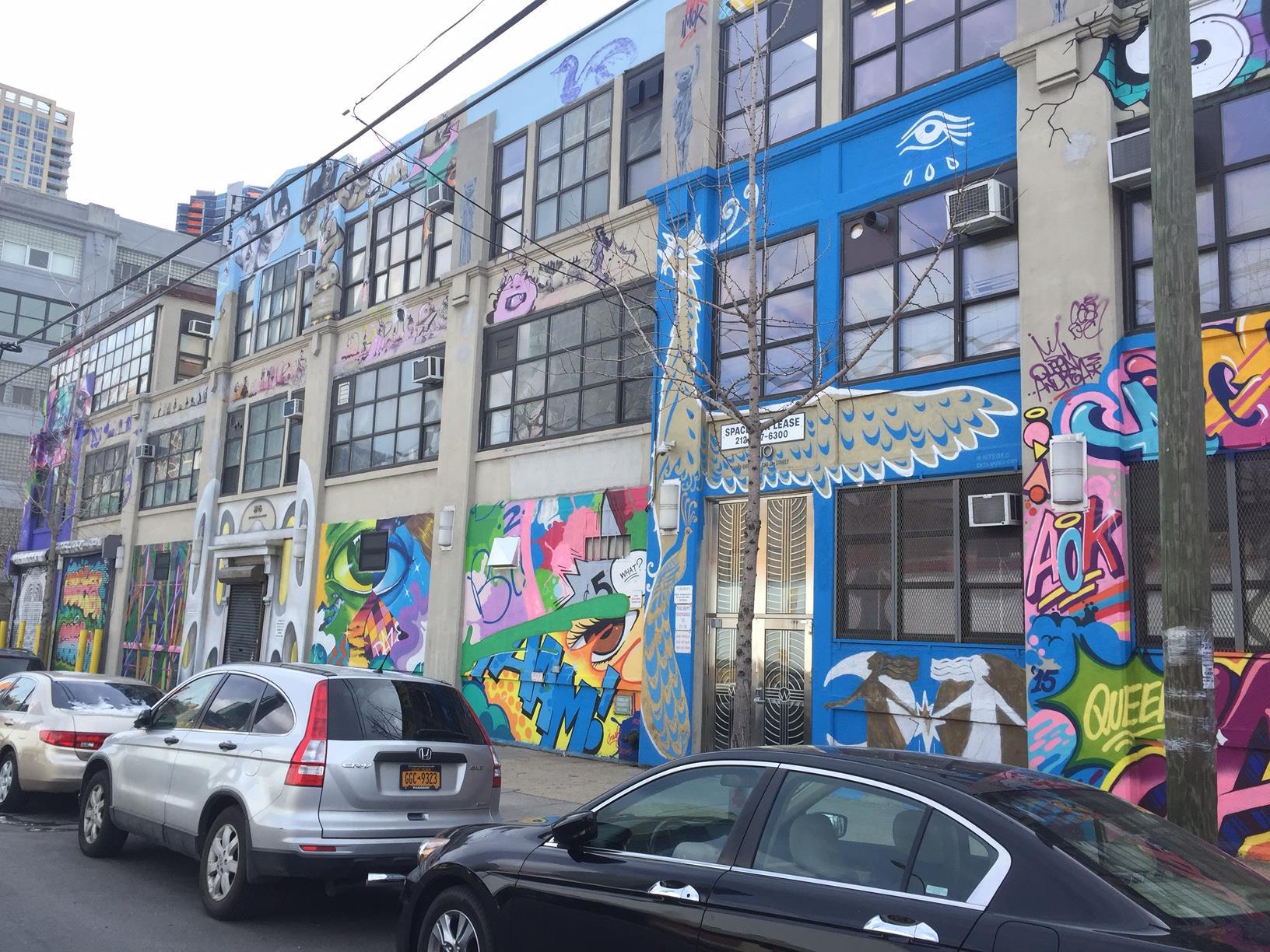
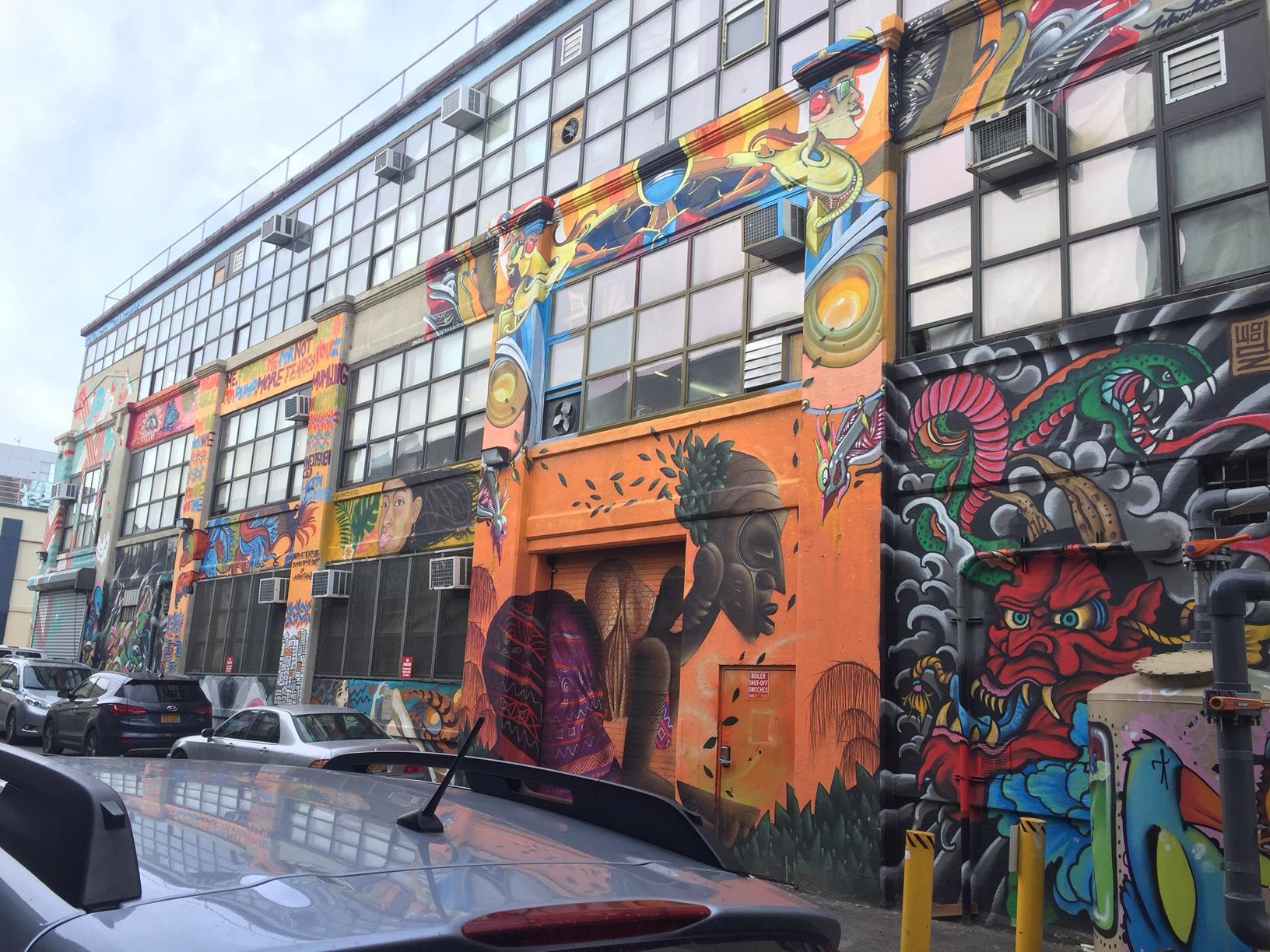
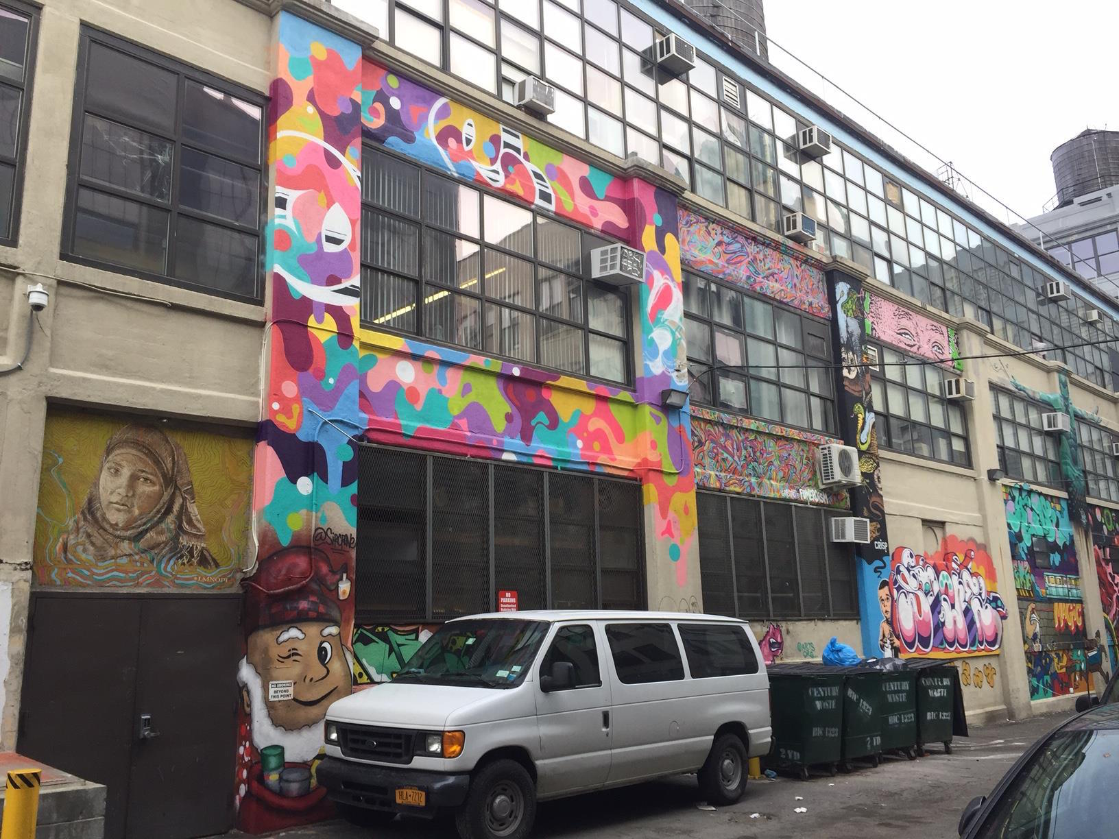
New York City has some of the world’s best street art, attracting artists not just from our 5 boroughs, but from all over the globe. Works of some of the world’s most famous street artists— Banksy, Invader, Crisp, Shepard Fairey, D*Face, ROA, & more— can be found on our walls.

Among them are Eduardo Kobra, from Brazil. Distinctive for his kaleidoscope theme, bold colors and lines, portraits & mash-ups, Kobra is one of the world’s greatest and most prolific muralists.

He has done work in the NYC area before, and some of those remain (a huge Bowie wall in Jersey City, and a Basquiat/Warhol wall in Williamsburg Brooklyn). But this summer, he returned on an ambitious journey to create a huge number of new murals. He and his crew were ubiquitous for months, working on one mural after another in Manhattan and Brooklyn. They started in late July in the East Village with a mural mashing up young and old Michael Jackson. They finally completed in early November, after a whopping 18 murals.

The project was called ‘Colors of Liberty’, and had that theme as a unifying idea across many of the pieces. In an interview, Kobra said “The intention of my artworks is to bring awareness about complex subjects, such as racism, violence, the use of firearms and violence in general and also the cause of immigrants. To reflect on all of this so we can find answers on how to make the world a better place.” He added, regarding his choice of city for this project that, "New York is where street art was born and I was influenced by the artists here... I owe so much of what I have learned to New York."

To help people discover these, I have created a map of all his NYC pieces:

(This map includes one piece— “Fight for Street Art”— from a previous visit of Kobra’s)

How many, if any, have you spotted yet? Do you a favorite?

Come discover some of these new walls on our Lower East Side Street Art Tour!

IMG_7089.jpg

Victorian Flatbush, Brooklyn

Time Out New York magazine listed our popular tour of Victorian Flatbush, in Brooklyn, as one of “10 fascinating architecture tours in NYC”. We were honored to be included there, and hope you will join us sometime to see why it was spotlighted as a unique NYC experience.

Flatbush itself is one of the original six towns of the formerly-independent city of Brooklyn, dating back to the Dutch colonial era. Remnants of this heritage are seen on the tour, including one of the city’s oldest cemeteries. After Prospect Park was built in the 1860s (back when much of Flatbush was still farmland), developers took notice of the potential for new neighborhoods in Flatbush. Just south of the park, starting the 1880s, several developers worked to build a wealthy suburb that would be different from the brownstone & row-house trend of the rest of Brooklyn. Instead, they aimed to build a more suburban neighborhood, filled with huge homes and mansions, private sporting clubs, all within walking distance of this new park (and a short train ride away from the beaches of southern Brooklyn). Thus was born “Victorian Flatbush”.

Half of these developments across the area were destroyed in the 1930s to make way for middle-class apartment complexes, but several historic districts preserve its more picturesque and historic parts.

Recently, the Brooklyn real estate blog Brownstoner published some unique, birds-eye view photos of the area as it had grown, circa 1907. These are great shots, and experts on this neighborhood’s history will spot some unique finds in the photo, which I’ll spotlight here.

Albemarle.jpg

In this large, panorama shot, on the upper right, I’ve circled a pedestrian bridge across the railroad tracks (today the tracks are used by the NYC subway). This bridge was placed along the most scenic road— Albemarle— to connect one end of the Victorian neighborhood to the other. Today, the rail tracks largely (with a few exceptions) mark the dividing line between the preserved section of the neighborhood and the post-1930s section. The bridge was demolished about 40 years ago, to meet the angry demands of the wealthy mansion-dwellers to better separate themselves from the working-class populations starting one block over. You can read the fascinating history of this rail line, and the forgotten bridge here.

The Brownstoner article also includes a close-up of the area near that bridge, the intersection of Albermarle and Buckingham Roads:

Albemarle2.jpg

Circled by me there is a mansion that no longer exists. It was built by developer Dean Alvord as his personal new home. He had decreed that, after his death, the home be razed and the land donated to the community for common use. Today, the lot is the home of the Flatbush CommUNITY Garden. If you look at the site today, the driveway and the foundation of the home are still intact, but otherwise it remains a (now membership-only) community garden.

Want to see all of these sites, and the larger neighborhood, as they look today? Take a look at the slideshow of images on our listing page for our Victorian Flatbush tour, and see our calendar of public tour dates. We can also do this as a private tour on many other dates.

Come see gorgeous suburban blocks, Victorian-style mansions, and history in central Brooklyn!

Finding Your Roots

Here at Custom NYC Tours, designing & leading custom-created walking tours is obviously our specialty. My bragging point is that I know all aspects of this city so well, if you can think of an idea for a tour, I can create it for you, and lead it. We’ve done fun ones recently… a historic overview of Brooklyn neighborhoods, street art with themes about gender or politics, movie & TV locations in Central Park, and more.

But my favorite type of custom requests involve helping families trace their roots back in historic parts of the city.

I had first done one of these in 2016, when I helped a man trace his childhood roots in Bensonhurst.

Earlier this year, I designed another walking tour for a woman from England who had ancestors that moved to Brooklyn in the very early 20th century. She was curious to learn about this side of her family, and what their life in America had been like. She had a few addresses of where they lived around the historic Park Slope neighborhood, and knowledge of their burial in nearby Green-Wood Cemetery. With this information, I crafted a tour of their former neighborhood (Brooklyn being so historically well-preserved, most of their homes still stood). Finally, we journeyed into the cemetery to tour this historic site, and visit her family members’ plot. Seeing how much the tour meant to her was a humbling experience for me in turn.

(As an aside, if you ever have the chance to tour Green-Wood Cemetery, it is highly recommended. Opened in 1838, it was New York’s first rural cemetery. Its tombstones and crypts are works of art in their own right, and there are monuments to the Revolutionary War, as its largest battle was fought on this site in 1776. The cemetery’s popularity as a pastoral retreat helped inspire the demand for New York’s Central Park.)

And, earlier this Autumn, I did a similar tour in historic Brooklyn, albeit with a more local group. The group— now living around the various suburbs of the region— knew that their grandparents had grown up, and started their family, in Brooklyn, and were curious to match locations to family photos and stories. Similar to the woman from England, family records provided them with specific addresses. I created the tour from there.

We visited three historic, but very distinct, Brooklyn neighborhoods. First, Williamsburg. Today, better known for its “hipster” reputation, Brooklyn grew from a 19th-century industrial hub to a thriving immigrant residential neighborhood after the opening of the Williamsburg Bridge in 1903, when many growing Jewish families moved there from the overcrowded tenements of the Manhattan’s Lower East Side. A few blocks from the bridge’s exit, we found the beautiful apartment house where their family once lived. This section also included looks at the gorgeous buildings along Broadway, once the thriving Wall Street of old Brooklyn. After WWII, even as the orthodox segment of the population grew, new immigrants from Puerto Rico and the Dominican Republic moved in, creating a rich new cultural blend in the neighborhood fabric. From there, we traveled down to Crown Heights, with its vibrant mix of orthodox Jewish population and Caribbean immigrant families. There, we saw a second home that the growing family once inhabited. Finally, we traveled past Prospect Park to visit historic Flatbush, near the “Victorian” sub-section, to see a pre-war apartment complex the family once called home. The eldest member of the group had grown up as a young girl in that building and recognized its steps and lobby. We ended by recreating an old family photo.

All together, three very different neighborhoods, all tied together by family history. In many ways, that is the story of New York.

The locations of the families’ roots, in Brooklyn historic neighborhoods.

The locations of the families’ roots, in Brooklyn historic neighborhoods.

If you, or anyone you know, is looking for a similar tour, I am happy to assist in creating this unique experience. New York’s story is about its neighborhoods and its people, and I would love to help you discover where your family fits into this ongoing history.

How New York Created Christmas

Many people do not know how much of modern Christmas iconography and traditions are rooted in New York's history.

Prior to the early 19th-century, Christmas in America was a far more low-key holiday than it is today… a quiet religious holiday for families, celebrated differently (if at all) across the young nation.

The first major connection between New York and the global Christmas mythology comes from writer Washington Irving (of "Rip Van Winkle" & "The Legend of Sleepy Hollow" fame). Upset that there were few unifying holidays in early America, Irving worked to change that. In his 1809 “A History of New York”  (a comical retelling of the city's Dutch era), he declared the European gift-giver St. Nicholas to be the state’s patron saint, claiming that his image appeared on the masthead of the first Dutch ship to arrive in New Amsterdam.

St. Nicholas Day, or the Feast of St. Nicholas, was for much of history a separate holiday in on December 6 associated with the gift-giving saint. One way this holiday was celebrated was placing shoes in the foyer before bedtime the night before. The origin of Christmas stockings?

(And how did the Dutch say Saint Nicholas? Sinterklaas. Later Anglicized to, you guessed it, Santa Claus.)

St. Nicholas then himself became tied to the Christmas holiday thanks to another author, Clement Clarke Moore, who lived in a mansion on Manhattan farm land in what later became the Chelsea historic district. In his famous short story, “An Account of a Visit from St. Nicholas", originally published in 1823, Moore described the saint as “a right jolly old elf,” based on “a portly rubicund Dutchman,” in the neighborhood, with his “eight tiny reindeer,” with some other elements borrowed from Irving’s version of the Saint. St. Nicholas Day is traditionally celebrated in early December, but Moore’s poem set his visit on Christmas Eve, informally tying St. Nicholas to the holiday for the first time. This, in turn, ties the concept of gift-giving to the holiday.

It cannot be overstated how much of our modern Christmas mythology originates from Moore’s story and depiction of “St. Nick”.

Then, in the 1860s, American political cartoonist Thomas Nast further cemented this depiction with drawings in the NY-based publication Harper's Weekly depicting St. Nick/Santa Claus as a jolly, bearded, fat man in a fur-trimmed cap. This iconic look is the one that since became the default style worldwide for depicting him.

More traditions kept piling up throughout NYC history... Santa's inclusion in Thanksgiving parades, public Christmas trees, decorated store windows, and more.

Today, Christmas remains New York's most enchanting season, and is the busiest tourism season for the city. Holiday markets, elaborately-decorated trees everywhere, bell-ringers... between Thanksgiving and Christmas Day itself, you are hard-pressed to find anywhere in Manhattan where the holiday is not front and center.

Looking to experience this magic? Contact us for a custom tour!

Xmas.jpg

Space Invader in NYC: A Guide

[UPDATE: As of Autumn 2024, sadly less than 20 remain in NYC. New York is a great city for street art, but also frankly lacks the respect for the art other cities have. Murals are tagged regularly, and lots of general vandalism. This unfortunately extends to Invader’s work, which is increasingly stolen or destroyed by selfish people who want to ruin something enjoyed by countless people, for their own satisfaction.

Given this, customized Invader tours are no longer available.]


Most street art fans are familiar with the work of French artist Invader. Taking his name from an early arcade game (and his style from those early 8-bit graphics), Invader began a global project in 1998 called Space Invaders, affixing tile mosaics to the sides of buildings. Today, his work can be found in large cities in dozens of major countries. He is one of the world's most famous (and still anonymous) street artists.

Invader has visited NYC several times and left behind numerous installations. Many, as happens often, have been removed, vandalized, or stolen. Know someone vandalizing these? Report it! My aim here is simply to create a list of all remaining pieces in NYC that I have personally verified... so that my fellow street art fans can enjoy them. If I am missing any, or if any are gone since I last saw them, please comment below!

A few of these are part of my street art tours. Contact me today!

Manhattan:

  1. Lower East Side: On Ludlow St, between E. Houston & Stanton, look across from the Hotel Indigo, for a classic Invader

  2. Lower East Side: Also on Ludlow, between Delancey & Broome, look up on the east side of the street for a crowned Invader.

  3. Lower East Side: On Broome St, between Allen & Eldridge, look above the pizza shop awning for Leonardo of the TMNT.

  4. Lower East Side: On Bowery, between Broome & Delancey, look up on the east side of the street for Michelangelo of the TMNT.

  5. Lower East Side: On Lafayette St, between Prince & Spring, look up on the east side of the street for a flowery Invader.

  6. Lower East Side: On Bowery, between Hester & Canal, look up on the fire escapes on the west side of the street, for a strip of Invaders.

  7. East Village: On St Marks Place, look above Isabella for a mosaic of Lou Reed.

  8. East Village: On Avenue A & E. 3rd, look up on the northeast corner for a classic Invader.

  9. Chelsea: On W. 14th St, between 8th & 9th Aves, look up on the south side of the street for a large Big Apple Invader.

  10. Chelsea: On W. 22nd St, btwn 10th & 11th, look on the south side of the street for a Pac Man ghost-style Invader.

  11. Meatpacking District: On 10th Ave & W. 17th St, look above Artichoke Pizza for Donatello of the TMNT.

  12. Hudson Square: At Pier 40, look on the south end of the building for a classic Invader.

  13. Williamsburg Bridge: On the pedestrian path of this bridge, closer to Manhattan, just before the FDR Drive, look to the right on the tower. On the arch, there is a small Invader facing west.

Brooklyn:

  1. Bushwick: On Troutman St, between Wyckoff & Irving, keeping looking up on the west side of the street for a tribute to Cost & ENX.

  2. Bushwick: On Gardner St, between Johnson Ave & Randolph St, look up on the west side of the street for Joey Ramone.

  3. South Williamsburg: At Broadway, between Keap & Rodney Sts, look above KidSuper for a classic Invader.

  4. Greenpoint: At the corner of Nassau & Kingsland, look above the pizzeria for pizza-munching Invader.

  5. Bed-Stuy: On St. Johns Place, between Utica & Rochester, look up on the south side of the street for a speeding Invader.

Any questions? Please comment below!

IMG_5032.jpg

Found the map useful?
Book a tour! Or, send a gratuity to me (Venmo: @Jeremy-Wilcox ).

A Guide To NYC Public Transportation

I've been working on a series here for tips for common tourist concerns. I recently did a post on the most common street scams to avoid in NYC (hint: anyone tries to hand you anything? keep walking!). Today, I present my tips & guide to using public transportation in New York.

Public transportation is the best way to get around New York, and the best way to experience the city as the locals do (locals rarely take cabs). It can seem intimidating at first, but follow our guide, and you’ll be in the know in no time.

  1. Know the map.
    Download a copy of the NYC subway map to your smartphone (physical copies are available at most station booths, if you can find one). A PDF is here. Keep track of service changes on the MTA website. Weekend-specific changes (which occur every weekend, so be prepared!) are available here. Google Maps also now provides a public transit option, in addition to car and walking directions.

    Also note that some subway stations have separate entrances (and platforms) for uptown trains versus downtown trains. Check signs to make sure you are headed the right way.

  2. Metrocard.
    First thing you must know is that NYC has a flat-fare system. Unlike most cities where your fare is based on zones/distance traveled, there is one flat fare for NYC, no matter you destination. Simply swipe in to the system, and you are in at that one fare until you exit... transfers to other lines (through connected stations) have no additional cost. Within around 2 hours, you can also transfer to a bus with your Metrocard at no additional cost. The standard fare is now $2.75

    You can purchase Metrocards in every station at the vending machines, or from an attended booth. Some station entrances may not have a machine, if so, simply go back out and enter the station at the main entrance.

    There are a couple of different types of Metrocards available (info here). The first is the Pay-Per-Ride Metrocard, in which you put a certain amount of $$ on the card, and your fare total is deducted for every swipe. This is good for several people to share. The second type is an Unlimited Metrocard, in which you pay a flat fee and get unlimited swipes for a certain period... 7 days, or 30 days. These unlimited cards can not be shared as, after your swipe, the card will be locked out for about 15 minutes. If you will be in NYC for around a week, we highly recommend purchasing the 7-day Unlimited Metrocard for every member of your group or family.

    When swiping your Metrocard at a turnstile, a swift and straight swipe will avoid read errors.

  3. JFK AirTrain.
    The AirTrain monorail system provides a connection between JFK airport and two nearby transit hubs (check signs to make sure you are headed the right way)... Howard Beach (with access to the A train), and Jamaica (access to E and J lines, plus access to Long Island Railroad). Payment for the AirTrain is by Metrocard (pay-per-ride cards only). It is $5 each way.

    It also provides connections between terminals inside the airport at no cost.

  4. The different systems.
    The main NYC transit system-- ie. what your Metrocard will pay for-- consists of the following: the subways, city bus lines, and the Roosevelt Island tramway (info on the latter here). But there are several other transportation options in the city that your Metrocard will not cover, and will require separate fares. Here's a primer:

    A) NYC Ferry: NYC's new, official ferry service is a great way to travel between the city's waterfront areas. The fare is the same price as a subway ride-- $2.75-- but requires a separate ticket.

    There are also other ferry options, such as NY Waterway and NY Water Taxi.
    (not even including the many sightseeing boat/cruise companies)

    B) Long Island Rail Road: The LIRR is a commuter train system that connects NYC to the suburbs of Nassau and Suffolk Counties (collectively known as Long Island). To ride this system, a separate ticket must be purchased at stations. If you do wish to ride a LIRR train, please buy a ticket in advance, as purchasing tickets on board is almost double the cost of an advance ticket.

    C) Metro-North: Metro-North railroad connects NYC to its far outer suburbs of upstate New York and Connecticut. As with LIRR, tickets should be purchased before boarding.

    D) PATH: Path trains connect certain lower Manhattan neighborhoods to specific areas of New Jersey popular with cross-state commuters... Hoboken, Jersey City, and access to Newark Airport. The Path system does take Metrocards, but only pay-per-ride cards (unlimited Metrocards not accepted), though there is no free transfer between Path and the NYC transit system.

    E) NJ Transit: NJ Transit is a commuter rail system that connects NYC (via Penn Station) to cities all across New Jersey.

    F) Staten Island Ferry: The commuter boat between Manhattan and Staten Island. This one, as you may know, is free and requires no tickets.

  5. Getting help.
    Should you find yourself with questions during your travels, you have many options. First is to just ask! Contrary to stereotypes, most New Yorkers are very friendly and happy to assist (except maybe during rush hour). Second, check the web! All underground stations now have free wifi service. Finally, find an MTA employee! It is their job to help point you in the right direction.

We hope this helps, and safe travels!

The Thrill of the Chase

As I noted in a previous entry, I love a good challenge. Art events or promotions that get New Yorkers to go around and explore all corners of the city are a favorite of mine. In the past, New Yorkers have been asked to run around hunting for cows, baseball statues, and (appropriately) easter eggs.

The current event is one is called the La Mer Wave Walk, sponsored by La Mer and Project Zero, to draw attention to ocean conservation efforts. 54 wave sculptures have been installed across all 5 NYC boroughs, in anticipation of United Nations Oceans Day on June 8. The wave sculptures will be removed and auctioned off after June 21. Some of the people who designed the sculptures include: Richard Branson, Bernard Fowler, Queen Noor of Jordan, Vivienne Westwood, Keith Richards, and many others. This page has a map where all the waves are placed.

I am attempting to photograph all 54 waves over the next week or so. As I find them, I will be uploading my photos to the Flickr account linked in the image below:

The Changing NYC Skyline: An Addendum

A month ago, I blogged about my day-long exploration of the changing New York skyline. The past decade has seen the greatest period of growth in the city, in every possible meaning, in over half a century. The skyline of NYC is iconic. But, for better or worse, in a decade you may no longer recognize it.

Time Out New York has a good article along this same line, specifically focused on the numerous towers in early stages that have not yet gone up... but will soon transform Manhattan. It's definitely worth a quick read.

Covering Queens in Art, Top to Bottom

More and more people are discovering that the city's fastest growing art scene isn't in Manhattan... it's in Queens. The waterfront neighborhoods around Long Island City have a growing number of art galleries and co-working spaces. They also an impressive collection of museums: MoMA PS1, the Sculpture Center, The Noguchi Museum, Socrates Sculpture Park, & more. And in the warmer months, you can also stop by the popular LIC Food & Flea festival, and catch the views from the waterfront parks.

But Long Island City (or, LIC) has always been synonymous with street art. The neighborhood once housed the the world's premiere “graffiti Mecca”: 5Pointz... aka, The Institute of Higher Burnin', aka 5Pointz Aerosol Art Center. Artists from all over the world would apply for a chance to paint on this site. The building itself, while huge (200,000-sq-ft/19,000-m2!), was not itself otherwise remarkable. It was simply a privately-owned factory building that the owner had converted inside to rented artist studios, and turned on the outside to a heavily-curated graffiti gallery. (And curated it was: artists would have to submit portfolios/samples for a chance to make their mark on its walls)

Most New Yorkers became familiar with it while riding the 7 train, as the massive complex, and its painted walls, was the first thing one would see as the train came above ground in Queens.

The building was even featured in TV & movies, such as the climax of the 2013 film, "Now You See Me".

The building was even featured in TV & movies, such as the climax of the 2013 film, "Now You See Me".

Alas, the growing popularity of Long Island City ultimately sealed 5Pointz's fate. The building's owner was made a generous offer for the land by developers, and he sold. After a failed effort by artists to have the building landmarked, it was demolished. A large, luxury residential complex is currently going up where it once stood. Some 5Pointz-era street art on the other end of Davis St is all that remains of the former mecca.

RIP.

RIP.

Today, the NYC street art community has largely splintered, with efforts centered around new areas like Bushwick or the Lower East Side or Welling Court in Astoria.

But one organization is looking to create a new mecca nearby in LIC. Arts Org NYC is a group that has worked on numerous projects. Their main project now is called "Top to Bottom", centered at a huge building at the intersection of 21st St & 43rd Ave, just a 10-minute walk from where 5Pointz once stood. The project was recently spotlighted on The Huffington Post.  They have gathered some very popular street artists to cover their building from, you guessed it, top to bottom with gorgeous and fun murals. “It’s just a beginning,” creative director James P. Quinn said.

I visited the site today, and was so happy to see that street art in LIC is still thriving. It inspired me to do something I've been thinking about for a while... create a tour of Long Island City, focused around its street art scene. That will be added to this site very soon. I love this neighborhood in general, and think it's a great way to introduce people to the very underrated borough of Queens.

Here is a slideshow of some of my photos from today's exploration.

Know anyone interested in this type of tour? Please spread the word!

My Tour Philosophy

In the FAQ section of this website, the first question I ask and answer is "Why should I choose you?". After all, there are many options for tours in New York-- walking guides, double-decker buses, water taxis, & more-- and all provide an amazing service. So, again, why me? The answer, I believe, is that I am providing something more personal. As my home page says, I aim to create memories.

I've seen guides leading big groups that will spend 2 hours covering only a few blocks in a circle. Stopping every few minutes to stand ahead of the group and give them a 10-15 minute static history lecture on a corner. I admire the amount of time & scholarship that goes into such a tour. But, I also see the participants staring at their phones, shuffling their feet, whispering among themselves, and I wonder... is this tour a lasting memory for them?

I travel a lot myself, and love taking tours in the cities I visit. But one thing that I found, and my fiancé concurred, was that in the days after the tour, I had only fleeting memories of the facts, dates, and other information thrown at me during the tour. But in a good tour, we had a clear memory of specific things that we saw, the basic historical context for what we had seen, and some of the little secrets the guide imparted onto the group. Plus, great photo opportunities. That is what lasted. So I decided to give tours that aim to maximize that experience.

An example: When I started doing High Line tours, as I pointed out the Hudson River at the start, almost every tour group has asked me to show them where on the river Sully landed the plane (answer: parallel to the USS Intrepid and the Manhattan Cruise Terminal). I realized almost of them would remember that. And the art pieces & design flourishes that I showed them. And the general experience of the park. But probably not the fact that the original High Line rail viaduct opened in 1934, or that the Friends of the High Line's annual operating budget is $11.5 million dollars.

In short, I focus more on show versus tell.

(Or, think of my tours like an Aaron Sorkin show: Walk and talk.)

I limit most of my tours to 10-12 people max to make sure everyone has a personal experience, and is able to talk to me and ask questions (or have me take pictures of them!). I provide customers with the basic history they need, show them some historical photos for reference, and encourage follow-up questions as we go. The tour is a conversation, not a lecture. 

I aim to cover as much ground as possible in every tour, to maximize how much a visitors sees in their limited time in NY. For instance, the Financial District and the World Trade Center? That's one tour for me, not two tours... after all, they're right next to each other, and part of the same (continuing) story of downtown. So you will walk a lot on my tour. But you will see so much more than on many other tours, and (I hope) have a real lasting memory of the experience.

For some visitors, that's not what they want. And that is fair, and I am happy to point such visitors toward other great companies I know who can give them the experience they need. But if you are a traveler (or a local) who prefers the type of tour that I've described, then... that's why me.

I love doing these tours. And I hope that passion will be contagious.

Come On Down To The World's Fair!

I'm excited to be soon offering even more dates for my World's Fair history of Flushing-Meadows, in Queens. I've written about this tour before-- such as my recent post on the Fair's connections to the Disney theme park empire-- as it is a favorite of mine to lead. And it's a perfect time to visit... due to the warm winter, I already saw cherry blossoms in early bloom there yesterday!

Flushing Meadows-Corona Park is actually larger in size than Central Park (fact: the latter is actually only the city's fifth-largest park). It sits on a former dumping ground, which was derided as "a valley of ashes" in F. Scott Fitzgerald's 'The Great Gatsby'. The land was cleared and turned into park-land by famous city planner Robert Moses to become the site of the 1939 World's Fair (which was a hit with crowds, but a financial failure). There is only one building remaining from that Fair... which later became the first headquarters for the United Nations, was re-purposed for the 1964 Fair, and currently houses the Queens Museum. That museum still houses an exhibit from 1964 (since updated)... the popular Panorama of the City of New York, which depicts all of the buildings in the entire city in 1:1200 scale. It must be seen to be believed. We see all of this on my tour.

(It is this park that, of course, hosts the annual US Open tennis tournament.)

On this tour, we also pass the following World's Fair artifacts & landmarks: the iconic Unisphere, the New York State Pavilion, a time capsule, numerous statues, Rocket Park, old streets and water fountains,  a Jordanian marble column which dates back to 120 AD, and much more.

Learn how these two Fairs reflected the times they were in, while looking to the future, and how they re-shaped New York City as a whole for years to come.

I will provide images & stories from the past....

....While we tour its present and learn of its future:

I believe this is a fun & easy tour for visitors of all ages... whether you visited the World's Fair, and want to re-live those memories, or you are young and want to discover what Queens has to offer.

Interested? Contact me!

Saying Goodbye To The Waldorf-Astoria

The Waldorf-Astoria is one of New York's most beautiful and historic hotels. It had been one of the popular stops on my Landmarks of Midtown tour. But this week I, and many New Yorkers, were visiting it for the purpose of saying goodbye.

This icon of midtown east is closing at the end of this month, for a multi-year reconstruction that will see most of its space converted into luxury condominiums. The Plaza Hotel went through a similar conversion several years ago. So while it will technically still exist, it won't be the same, and its gorgeous interiors no longer open to the public as they are now.

The Waldorf-Astoria has a storied past. It has hosted every single US President since Herbert Hoover (no other hotel can claim that), as well as celebrities and dignities from all over the world. Countless banquets and events have been held there. It has been featured in countless movies and TV shows.

The famous duel name comes from two separate hotels housed a little further downtown, dating back to the late 1800s, where the Empire State Building stands today. William Waldorf Astor & John Jacob Astor IV (who were cousins!) owned two competing hotels right next to each other. The two eventually reconciled and connected their hotels via a walkway (dubbed "Peacock Alley"). The building was sold, and then demolished, to make way for the Empire State. The 'Waldorf-Astoria' name was sold to developer Lucius Boomer, who constructed a new hotel on Park Avenue 15 blocks north. When it opened, it was the largest & tallest hotel in the world. Its very name quickly evoked luxury and grandeur.

If you have time over the next day or two, I think it is worth it to head over and say goodbye to this Art Deco-era landmark. The staff have been incredibly open and accommodating to the many visitors who have come to take one final look. Or, if you can't, enjoy a sample below of some of the photos I took on today's exploration.

The Changing NYC Skyline: A Guide

New York City's skyline may be infamous, but it is never static. It has always changed (and risen!), and that is more true now than at any time since the 1930s. So I have decided to create this comprehensive guide to the most high-profile additions to Manhattan's skyline (not even factoring in all the development along the Brooklyn & Queens waterfront!).

Let's start with the most famous change... the new World Trade Center. Everyone knows One World Trade Center, the tallest building in North America (thankfully the rumored "Freedom Tower" name was abandoned). But the site consists of numerous other skyscrapers. The original WTC site had seven buildings. The new WTC was to have seven as well, but it was cut back to five. 1, 3, 4, & 7 are built (3 is just topping out this year), with 2 yet to come, in addition to a performing arts center.  In between all of these, of course, sits the memorial park and museum.

This is a rendering, not a photo. From left to right: One, Seven, 2, 3, and 4.

This is a rendering, not a photo. From left to right: One, Seven, 2, 3, and 4.

Next is the biggest addition to the skyline... literally. 432 Park Avenue, completed just over a year ago, topped out at 1,396 ft (425.5 m). You may have seen it while near Central Park; it is the very tall and thin behemoth towering over its puny neighbors. It is the second-tallest building in NYC (only One WTC is taller), and is currently the tallest residential in the world. Apartments here started at around $18M. Due to both its massive height, and thin frame, the window grid & interior space of 2 floors between every 12 occupied floors are left open to allow wind to pass through (to prevent swaying). It has become a controversial symbol of New York becoming, as former mayor Michael Bloomberg said, "a luxury product".

The next biggest change is still at foundation level. One block north of Grand Central Terminal, One Vanderbilt is just beginning to be built. When completed in a few years, it will be NYC's third-tallest building, at a height of 1,401 feet (427 m). As part of the project, developers are promising to add new access and connections to Grand Central.

Next up is another behemoth in early stages of construction... the so-called Central Park Tower (aka, the Nordstrom Tower), on W. 57th Street. At a proposed height of 1,550 feet (472m), it will be taller than 432 Park... though the latter will remain the tallest residential building, as this one will be mixed-use. It will be the tallest building by roof height in the US, surpassing Chicago's Willis Tower.

Rendering.

Rendering.

Moving over to the west side, we get to Hudson Yards, the most ambitious real estate development plan in NY since the original World Trade Center. Being built atop the Hudson rail yards, the city has billed this project as New York's "hottest new neighborhood". And it is indeed an entire neighborhood being built from scratch... over a dozen planned skyscrapers containing more than 12,700,000 square feet (1,180,000 m2) of office, residential, and retail space. The neighborhood will also feature new schools, parks, hotels, and restaurants. The project has already completed an extension of the 7 subway line to 34th St.

One architectural centerpiece will be a large public plaza featuring 'Vessel', which is being marketed as the Eiffel Tower of NYC. It will be a beehive-styled network of stairs, 16 stories in height.

Today, only a fraction of the project is completed.

Rendering

Rendering

Further down the adjacent High Line, there is more west side development, mostly high-end residential.

On the left, 520 West 28th St by the late Zaha Hadid (which will feature a $50M penthouse). On the right, the completed 10 Hudson Yards, now home to the offices of Coach and L'Oreal. The latter has a direct entrance from the High Line.

On the left, 520 West 28th St by the late Zaha Hadid (which will feature a $50M penthouse). On the right, the completed 10 Hudson Yards, now home to the offices of Coach and L'Oreal. The latter has a direct entrance from the High Line.

Walk a little south down the High Line, and you will soon see a new development at 76 Eleventh Avenue, by Bjarke Ingels. There will be two twisty condo towers, rising to 35 and 25 stories, respectively.

Rendering.

Rendering.

Further uptown, the Bjarke Ingels Group has already completed a major project, known as VIA 57 West. It sits right next to the West Side Highway. The building's design is referred to as a pyramid or a tetrahedron. It is a residential building rising 467 ft (142 m) and 35 stories tall. It has already won lots of architectural praise.

A little further east, near Columbus Circle, at W. 57th St & 8th Ave, is the Hearst Tower. Sitting atop the original Hearst HQ (completed in 1928), this decade-old skyscraper was designed by Norman Foster, best known for London's "Gherkin" tower.

Heading downtown now, we find a massive residential tower in trendy TriBeCa, which has already become an icon of the downtown skyline. 56 Leonard is a 821-ft (250 m) tall, 57-story condo building. Due to its unique shape, it has been dubbed by locals and the media as the "Jenga building".

Heading east from there, you will find New York by Gehry (aka, 8 Spruce Street), right near the East River. This 76-story skyscraper, Gehry's only other NYC work, was the world's tallest residential building upon completion, an honor that 432 Park uptown since took. As you enter the Brooklyn Bridge, turn around and you will see an amazing view of this building, along with the Woolworth Building and One World Trade Center.

In 10 years, the NYC skyline will likely change and grow even more exponentially.

Do you have any favorites among these new buildings? Or least favorites? Thoughts on the impacts these changes may have on the Big Apple? Share your opinions with me on social media... or contact me to plan custom walking tours of these sights!

The Legacy of Keith Haring

Keith Haring is one of the most famous street artists of all time. Even if you've never heard of him, odds are you've seen his work memorialized on clothing,  and other merchandise. He came from the same culture of "pop art" as Andy Warhol and others. Haring made a huge impact on the art world, despite dying at the far-too-young age of 31, in 1990.

Haring, in particular, left his mark on the street art in scene in NYC, and was one of the first to elevate the underground, illegal graffiti culture into something popular and mainstream. His most lasting NYC legacy is the Bowery Mural, a large wall on the corner of The Bowery & Houston Street. In 1982, he put a huge mural on the wall on that corner. He made the corner famous. Though that work is long-gone, that wall had become synonymous with art, and as the ownership of the building changed hands, and development grew around it, it was understood that the wall would need to remain a canvas for NYC's street artists. New murals now are painted on that wall seasonally.

However, one famous Haring piece in NYC remains. In 1986, Haring went to a random playground in east Harlem, and painted two murals, one on each side of a handball wall, to highlight the need to fight that era's crack epidemic. Not for the first time, Haring was arrested for vandalism. But the public and the press rallied around him, and he was let off with only a $100 fine. After the piece was itself vandalized, the Parks Dept asked Haring to come back and officially re-create his "Crack is Wack" mural. He did, and it remains today. It became so popular, that, after his death, the city officially renamed the entire playground the Crack Is Wack Playground.

And Haring's legacy remains on every other wall in NYC where street artists look to make their mark, and create a legitimacy to this form of art.

Taking The Subway

Occasionally, on my tours, I'll give a customer directions from a tour's end spot to their next plans, via the subway, and they are hesitant. Whether it's a mix of fear of the unfamiliar, safety concerns, or just a preference of the private comfort of a cab, I do sympathize.

But here's my professional opinion on why tourists should use the subway to get around:

  1. It's reliable! Our system is unique in the world, in that it runs 24/7. Short of a natural disaster, the trains never stop running. Don't risk getting stuck in traffic, or with a cab driver who doesn't know where you're going. Google maps offer public transit directions now... find the best/closest route, and get there fast.
  2. It's inexpensive! For $2.75, you get into the system, no matter how far you're going, transfer included. No fare zones. One ride, one fare. Plus discount fares for seniors, kids 44" or shorter are free.
  3. It's safe! Subway crime has remained on a steady decline over the last 30 years.
  4. Travel like a local! Everyone from construction workers to janitors to Wall St traders ride the subway. It's our city's great underground melting pot. You haven't experienced NYC until you've become a straphanger.
  5. It's an art scene! The MTA has an official arts program, that helps design station walls with beautiful art pieces, murals, and musicians. Each station is unique.

So there's my pitch.

And now, some tips!

  1. Grab or download a subway map (my favorite app: Exit Strategy). Know your routes, and plan your travel in advance. And, as noted before, you can get updated directions via Google Maps now.
  2. Check the MTA website before you go, particularly on nights & weekends... as off-peak repairs do cause trains to be re-routed or temporary service suspensions.
  3. Your best mass transit route to JFK from midtown: Take the LIRR (Long Island RailRoad)-- buy a ticket in advance at Penn Station!-- to Jamaica and take the AirTrain. This is the quickest way. To save some money, just take a Queens-bound E train to Jamaica instead for your AirTrain transfer. The AirTrain is $5 and stops at every terminal. Going to LaGuardia... well, the city's still figuring that out.