Finding Your Roots

Here at Custom NYC Tours, designing & leading custom-created walking tours is obviously our specialty. My bragging point is that I know all aspects of this city so well, if you can think of an idea for a tour, I can create it for you, and lead it. We’ve done fun ones recently… a historic overview of Brooklyn neighborhoods, street art with themes about gender or politics, movie & TV locations in Central Park, and more.

But my favorite type of custom requests involve helping families trace their roots back in historic parts of the city.

I had first done one of these in 2016, when I helped a man trace his childhood roots in Bensonhurst.

Earlier this year, I designed another walking tour for a woman from England who had ancestors that moved to Brooklyn in the very early 20th century. She was curious to learn about this side of her family, and what their life in America had been like. She had a few addresses of where they lived around the historic Park Slope neighborhood, and knowledge of their burial in nearby Green-Wood Cemetery. With this information, I crafted a tour of their former neighborhood (Brooklyn being so historically well-preserved, most of their homes still stood). Finally, we journeyed into the cemetery to tour this historic site, and visit her family members’ plot. Seeing how much the tour meant to her was a humbling experience for me in turn.

(As an aside, if you ever have the chance to tour Green-Wood Cemetery, it is highly recommended. Opened in 1838, it was New York’s first rural cemetery. Its tombstones and crypts are works of art in their own right, and there are monuments to the Revolutionary War, as its largest battle was fought on this site in 1776. The cemetery’s popularity as a pastoral retreat helped inspire the demand for New York’s Central Park.)

And, earlier this Autumn, I did a similar tour in historic Brooklyn, albeit with a more local group. The group— now living around the various suburbs of the region— knew that their grandparents had grown up, and started their family, in Brooklyn, and were curious to match locations to family photos and stories. Similar to the woman from England, family records provided them with specific addresses. I created the tour from there.

We visited three historic, but very distinct, Brooklyn neighborhoods. First, Williamsburg. Today, better known for its “hipster” reputation, Brooklyn grew from a 19th-century industrial hub to a thriving immigrant residential neighborhood after the opening of the Williamsburg Bridge in 1903, when many growing Jewish families moved there from the overcrowded tenements of the Manhattan’s Lower East Side. A few blocks from the bridge’s exit, we found the beautiful apartment house where their family once lived. This section also included looks at the gorgeous buildings along Broadway, once the thriving Wall Street of old Brooklyn. After WWII, even as the orthodox segment of the population grew, new immigrants from Puerto Rico and the Dominican Republic moved in, creating a rich new cultural blend in the neighborhood fabric. From there, we traveled down to Crown Heights, with its vibrant mix of orthodox Jewish population and Caribbean immigrant families. There, we saw a second home that the growing family once inhabited. Finally, we traveled past Prospect Park to visit historic Flatbush, near the “Victorian” sub-section, to see a pre-war apartment complex the family once called home. The eldest member of the group had grown up as a young girl in that building and recognized its steps and lobby. We ended by recreating an old family photo.

All together, three very different neighborhoods, all tied together by family history. In many ways, that is the story of New York.

The locations of the families’ roots, in Brooklyn historic neighborhoods.

The locations of the families’ roots, in Brooklyn historic neighborhoods.

If you, or anyone you know, is looking for a similar tour, I am happy to assist in creating this unique experience. New York’s story is about its neighborhoods and its people, and I would love to help you discover where your family fits into this ongoing history.

A Guide To NYC Public Transportation

I've been working on a series here for tips for common tourist concerns. I recently did a post on the most common street scams to avoid in NYC (hint: anyone tries to hand you anything? keep walking!). Today, I present my tips & guide to using public transportation in New York.

Public transportation is the best way to get around New York, and the best way to experience the city as the locals do (locals rarely take cabs). It can seem intimidating at first, but follow our guide, and you’ll be in the know in no time.

  1. Know the map.
    Download a copy of the NYC subway map to your smartphone (physical copies are available at most station booths, if you can find one). A PDF is here. Keep track of service changes on the MTA website. Weekend-specific changes (which occur every weekend, so be prepared!) are available here. Google Maps also now provides a public transit option, in addition to car and walking directions.

    Also note that some subway stations have separate entrances (and platforms) for uptown trains versus downtown trains. Check signs to make sure you are headed the right way.

  2. Metrocard.
    First thing you must know is that NYC has a flat-fare system. Unlike most cities where your fare is based on zones/distance traveled, there is one flat fare for NYC, no matter you destination. Simply swipe in to the system, and you are in at that one fare until you exit... transfers to other lines (through connected stations) have no additional cost. Within around 2 hours, you can also transfer to a bus with your Metrocard at no additional cost. The standard fare is now $2.75

    You can purchase Metrocards in every station at the vending machines, or from an attended booth. Some station entrances may not have a machine, if so, simply go back out and enter the station at the main entrance.

    There are a couple of different types of Metrocards available (info here). The first is the Pay-Per-Ride Metrocard, in which you put a certain amount of $$ on the card, and your fare total is deducted for every swipe. This is good for several people to share. The second type is an Unlimited Metrocard, in which you pay a flat fee and get unlimited swipes for a certain period... 7 days, or 30 days. These unlimited cards can not be shared as, after your swipe, the card will be locked out for about 15 minutes. If you will be in NYC for around a week, we highly recommend purchasing the 7-day Unlimited Metrocard for every member of your group or family.

    When swiping your Metrocard at a turnstile, a swift and straight swipe will avoid read errors.

  3. JFK AirTrain.
    The AirTrain monorail system provides a connection between JFK airport and two nearby transit hubs (check signs to make sure you are headed the right way)... Howard Beach (with access to the A train), and Jamaica (access to E and J lines, plus access to Long Island Railroad). Payment for the AirTrain is by Metrocard (pay-per-ride cards only). It is $5 each way.

    It also provides connections between terminals inside the airport at no cost.

  4. The different systems.
    The main NYC transit system-- ie. what your Metrocard will pay for-- consists of the following: the subways, city bus lines, and the Roosevelt Island tramway (info on the latter here). But there are several other transportation options in the city that your Metrocard will not cover, and will require separate fares. Here's a primer:

    A) NYC Ferry: NYC's new, official ferry service is a great way to travel between the city's waterfront areas. The fare is the same price as a subway ride-- $2.75-- but requires a separate ticket.

    There are also other ferry options, such as NY Waterway and NY Water Taxi.
    (not even including the many sightseeing boat/cruise companies)

    B) Long Island Rail Road: The LIRR is a commuter train system that connects NYC to the suburbs of Nassau and Suffolk Counties (collectively known as Long Island). To ride this system, a separate ticket must be purchased at stations. If you do wish to ride a LIRR train, please buy a ticket in advance, as purchasing tickets on board is almost double the cost of an advance ticket.

    C) Metro-North: Metro-North railroad connects NYC to its far outer suburbs of upstate New York and Connecticut. As with LIRR, tickets should be purchased before boarding.

    D) PATH: Path trains connect certain lower Manhattan neighborhoods to specific areas of New Jersey popular with cross-state commuters... Hoboken, Jersey City, and access to Newark Airport. The Path system does take Metrocards, but only pay-per-ride cards (unlimited Metrocards not accepted), though there is no free transfer between Path and the NYC transit system.

    E) NJ Transit: NJ Transit is a commuter rail system that connects NYC (via Penn Station) to cities all across New Jersey.

    F) Staten Island Ferry: The commuter boat between Manhattan and Staten Island. This one, as you may know, is free and requires no tickets.

  5. Getting help.
    Should you find yourself with questions during your travels, you have many options. First is to just ask! Contrary to stereotypes, most New Yorkers are very friendly and happy to assist (except maybe during rush hour). Second, check the web! All underground stations now have free wifi service. Finally, find an MTA employee! It is their job to help point you in the right direction.

We hope this helps, and safe travels!

Saying Goodbye To The Waldorf-Astoria

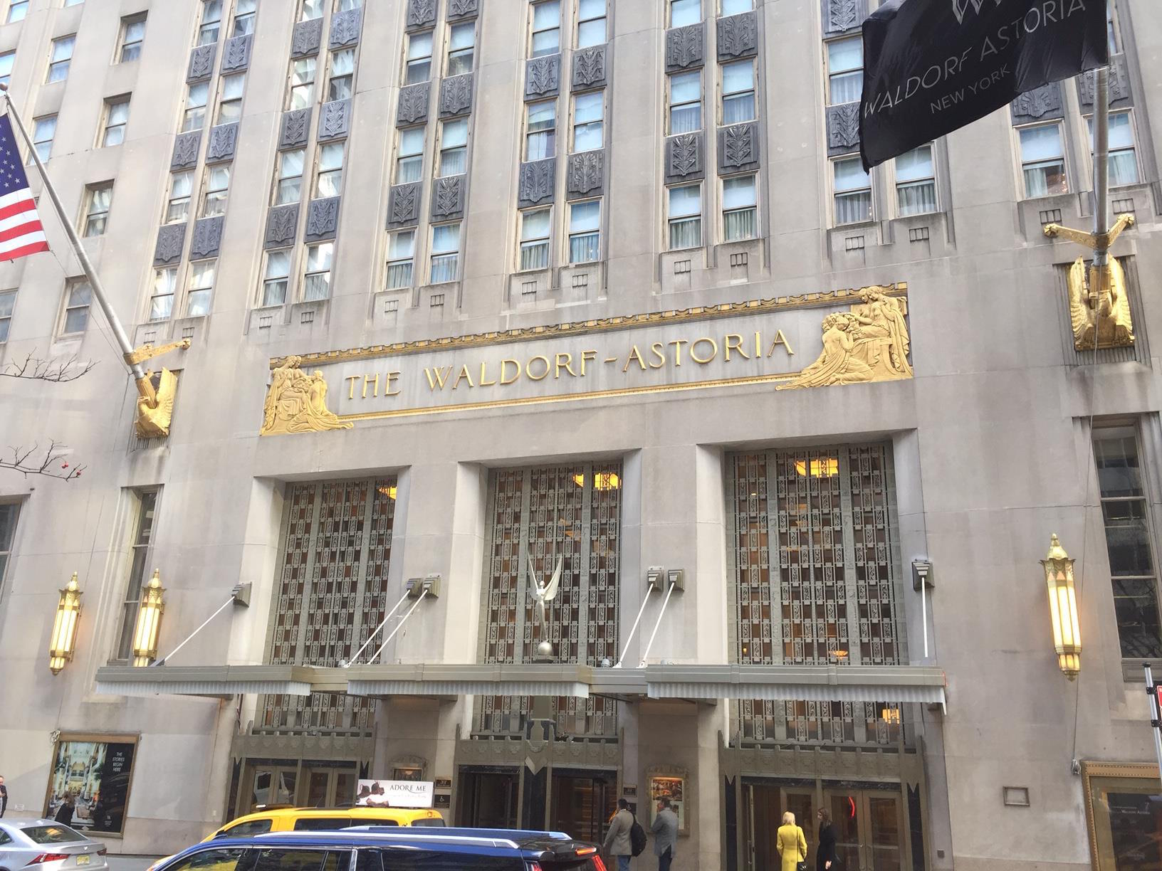
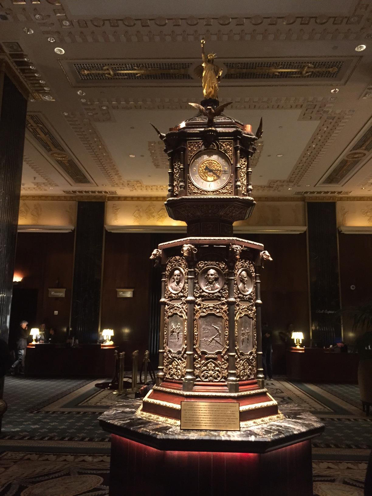
The Waldorf-Astoria is one of New York's most beautiful and historic hotels. It had been one of the popular stops on my Landmarks of Midtown tour. But this week I, and many New Yorkers, were visiting it for the purpose of saying goodbye.

This icon of midtown east is closing at the end of this month, for a multi-year reconstruction that will see most of its space converted into luxury condominiums. The Plaza Hotel went through a similar conversion several years ago. So while it will technically still exist, it won't be the same, and its gorgeous interiors no longer open to the public as they are now.

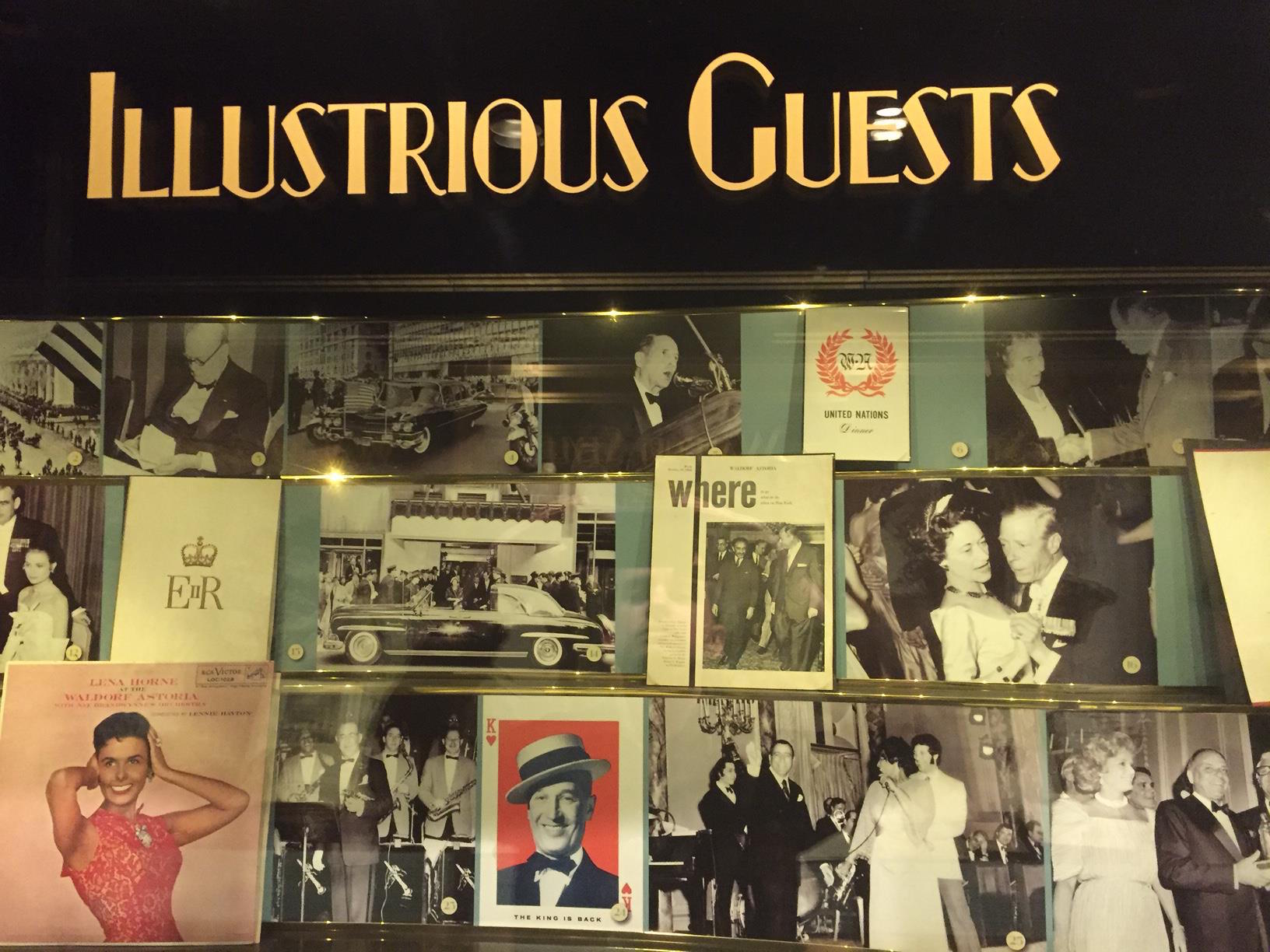
The Waldorf-Astoria has a storied past. It has hosted every single US President since Herbert Hoover (no other hotel can claim that), as well as celebrities and dignities from all over the world. Countless banquets and events have been held there. It has been featured in countless movies and TV shows.

The famous duel name comes from two separate hotels housed a little further downtown, dating back to the late 1800s, where the Empire State Building stands today. William Waldorf Astor & John Jacob Astor IV (who were cousins!) owned two competing hotels right next to each other. The two eventually reconciled and connected their hotels via a walkway (dubbed "Peacock Alley"). The building was sold, and then demolished, to make way for the Empire State. The 'Waldorf-Astoria' name was sold to developer Lucius Boomer, who constructed a new hotel on Park Avenue 15 blocks north. When it opened, it was the largest & tallest hotel in the world. Its very name quickly evoked luxury and grandeur.

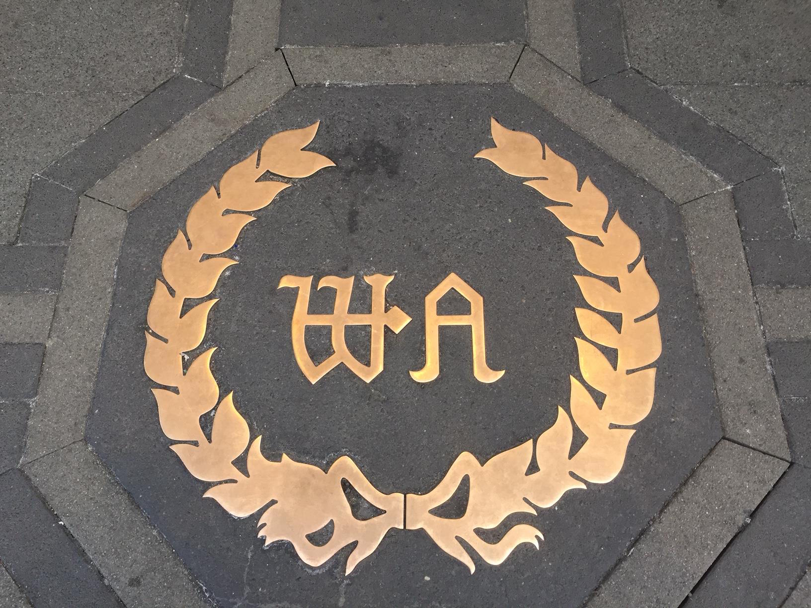
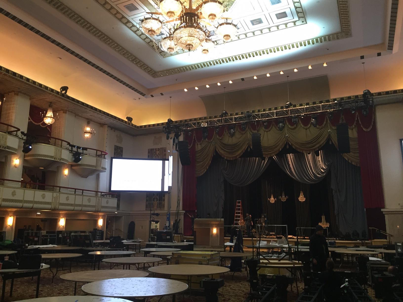
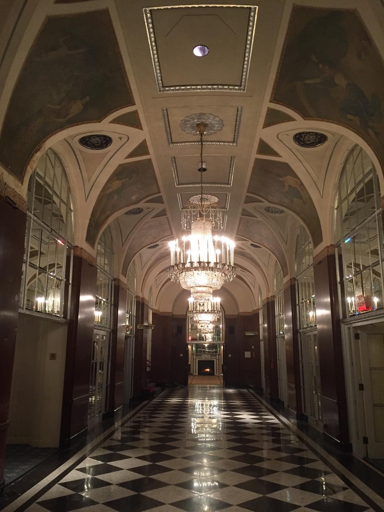
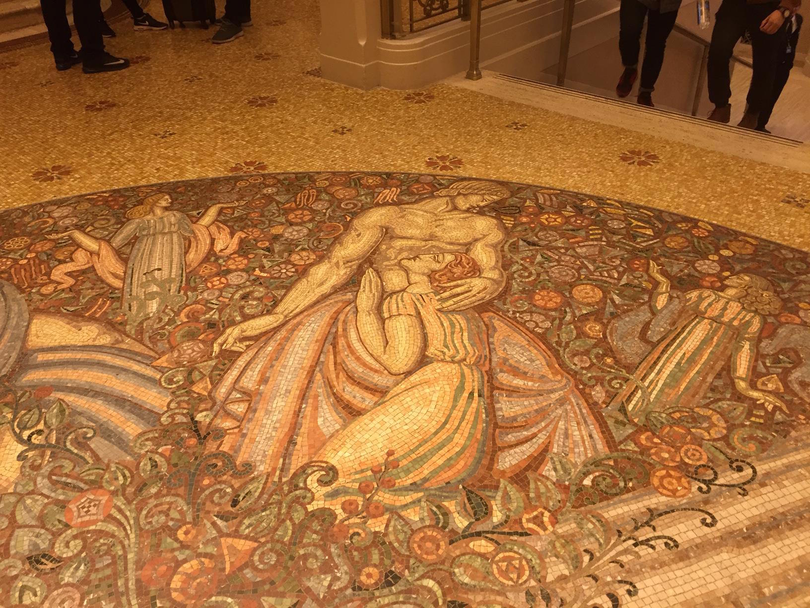
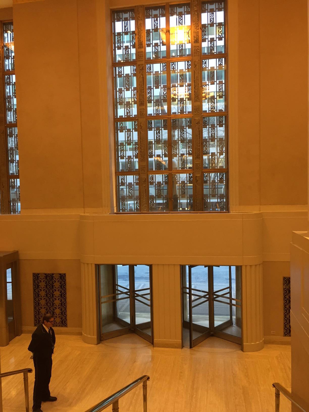
If you have time over the next day or two, I think it is worth it to head over and say goodbye to this Art Deco-era landmark. The staff have been incredibly open and accommodating to the many visitors who have come to take one final look. Or, if you can't, enjoy a sample below of some of the photos I took on today's exploration.

The Second Avenue Subway

The saga of New York's endlessly-delayed Second Avenue subway is so infamous, the TV series "Mad Men" (which took place during the 1960s) used it as a punchline in one episode. New York viewers laughed. And groaned. Even during the timeline of that series, the line was already overdue... a line going under Second Avenue to replace the old east side elevated lines was first proposed in 1919.

Today, through much of Manhattan, there is only one subway line that runs up the east side. If you've ever ridden the "Lexington lines" (4, 5, or 6 trains), you know that calling them overcrowded is an understatement the size of the Chrysler Building.

The Second Avenue subway went through numerous false-starts.... in 1929, 1932, 1944, 1947, and finally actual construction beginning in the early 1970s. The city's economic crash during that decade put that to an end. In 1981, Gene Russianoff, the city's top transit advocate, referred to the line as "the most famous thing that's never been built in New York City".

The city and its infrastructure has changed so much since that initial construction that a section of tunnel dug under Chinatown can no longer be used (they will eventually dig a new, deeper, tunnel through that neighborhood).

The project continued its existence in infrastructure purgatory, until a decade ago, when all the elements aligned (political will + actual funding, etc) and construction resumed. It coincided with the start of numerous hugely ambitious NYC projects... Hudson Yards, Brooklyn Bridge Park, the new World Trade Center, and much more. The city is currently building at a rate not seen in over half a century.

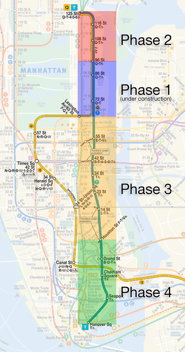
The decision was made to do the work over 4 distinct phases. The first 2 phases would simply see a re-routing of the Q line up the Upper East Side, to Harlem. The final two phases would bring it all down to a southern terminus, in the Financial District. A new color (teal) and line designation (T) were decided on for the new (eventual) line.

This may or may not happen before you die.

This may or may not happen before you die.

Construction began on Phase 1 (the Q re-route) in 2007, with construction currently wrapping up at a furious pace this month. The MTA insists the first phase will open for service before the ball drops in Times Square on New Year's Eve. Total cost so far: $4.4 billion.

Here's a look at how the new subway maps will look like with this completed:

image.png

And yet, that is just one phase down, three to go. Funding for Phase 2 (bringing the Q up to a connection with the 4/5/6 at 125th St) has yet to be approved by the state, and construction is not expected to begin until 2020 (or later?). 

But still after nearly a century, New York is finally getting a subway under Second Avenue. Even if just a few stops for now. Are New Yorkers happy? Or pessimistic? Probably somewhere in between. Ask most people in the city about the Second Avenue subway, and you'll get the same answer: "I'll believe it when I see it."

And maybe soon, seeing will be believing.